On my recent visit to Acadia National Park, I found some great locations for night sky photography that I am sharing in this post.
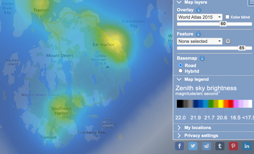
As an enthusiast of long-exposure photography (especially astrophotography) and I’ve been chasing the night sky during the last few years of living in the northeastern United States. When it comes to shooting the night sky, the availability of suitable conditions plays a key role in deciding the quality of the final image. Acadia National Park in Maine is a crown jewel in that regard, with some of the darkest night skies in the United States. Below is a snapshot of a light pollution map that kind of speaks for itself. This is a photographer’s paradise.
Preparation
The image that I had been mentally composing for a few months before the trip was a rocky shore in the foreground and the galactic center of the Milky Way rising from the horizon. To make this a success, I needed to plan ahead. Here are some of the things that went into account.
Firstly, the galactic center is at its brightest in the northern hemisphere during the months of July to October. So it was necessary to plan the trip around this time. The July 4 long weekend seemed to be the perfect opportunity.
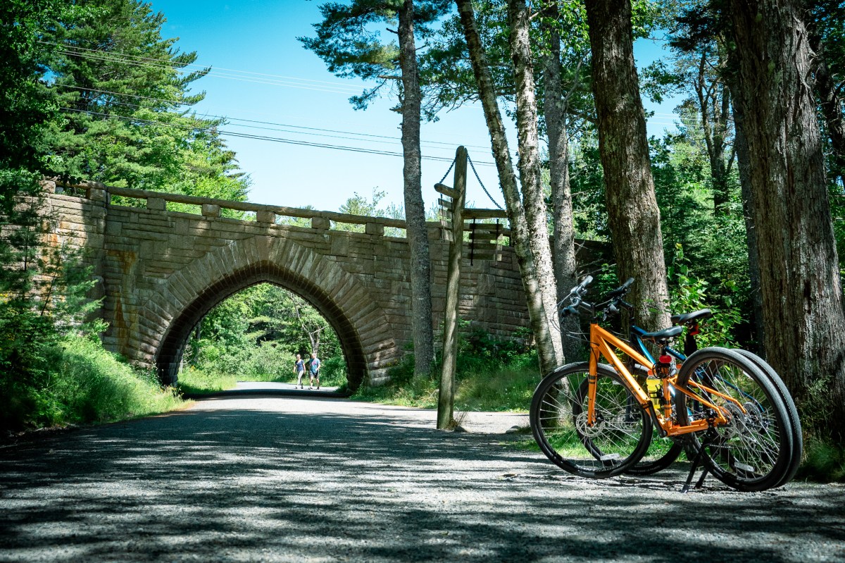
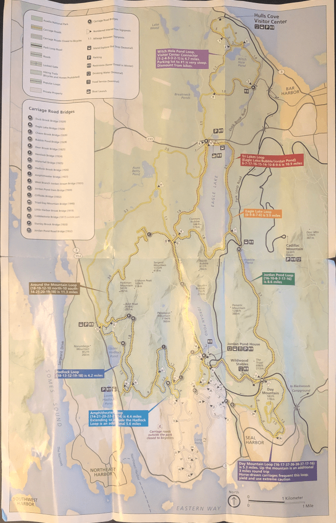
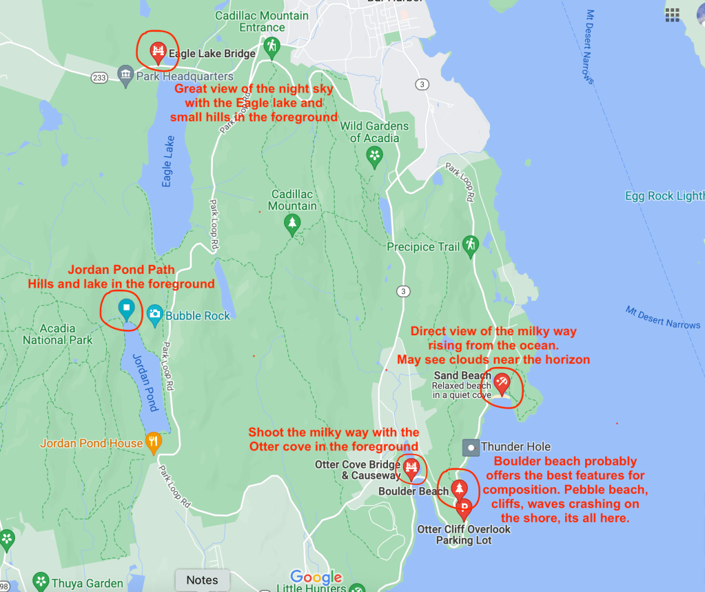
Next, I needed to find locations that offered good composition. After scouting for information online on Google maps, images, and blogs I decided to stick to the southeastern part of Mount Desert Island. This seemed to be both easily accessible by car, and free from light pollution. I ended up discovering these really nice spots, illustrated on the map below. See my Google Maps list for reference.
My camera gear for the trip consisted of my trusted Sony Alpha 7C, a Tamron 28-75mm f/2.8 lens, and a Sony FE 20mm f/1.8 G lens. I used the 20 mm for most of the night sky photography.

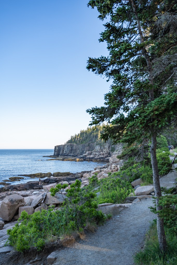
Sand Beach
Sand Beach was the first spot on my list. There is a large parking lot here with plenty of free spots at night. The beach is accessed by a short walk from the parking lot. If you are coming here at night, be sure to bring a small LED light to see through the dark. Preferably bring a red LED which helps in getting your eyes accustomed to the dark better. If you were thinking of your smartphone flashlight that works too, but I must warn you that you will bear the resentment of other photographers in the area. Bright white light is the greatest enemy of night photos. So be cool and bring a red one.
One rookie mistake that I committed was not checking the weather before I arrived at Sand beach. Apparently, there was a thunderstorm approaching from the ocean. Nevertheless, there were still quite a few people out there on the beach enjoying the night sky. I generally use a smartphone app for tracking the location of the galactic center, but it was clearly visible that night. I found a less crowded spot and started my work. Here is one of the first ones.
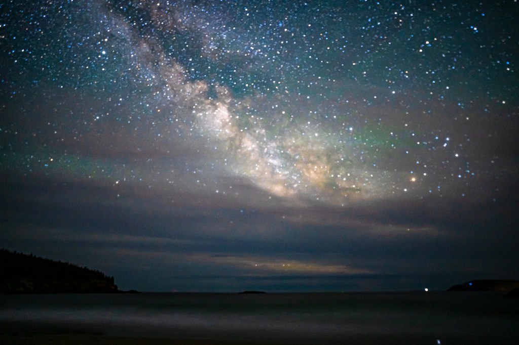
For the stats nerd: Sony Alpha 7C with 20mm G lens, 20 sec, f/1.8, manual setting, processed in Lightroom.
To be honest, this did not turn out to be as exciting as I expected. Sure I got the galactic center, but the foreground didn’t really have anything interesting. The wind and air moisture were also making it difficult to get a sharp focus on this foreground, and with the storm fast approaching (as you can see from the clouds) I had to leave soon or run the risk of being stranded for a few hours.
I had also planned on a series of intervallic shots of the milky way at this location but the storm threatened to pour water all over it (quite literally). I wish I could have captured more shots for a multisecond 24fps video, but here are the frames up until the moment I had to leave.
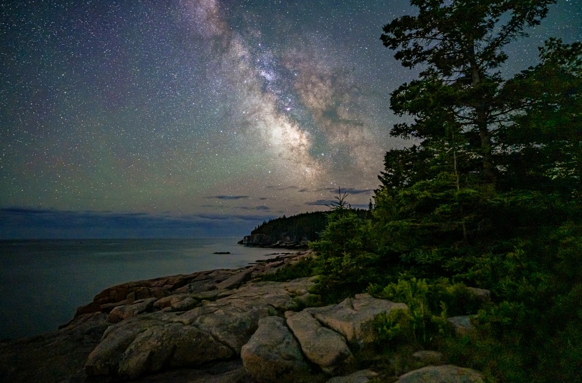
Ocean Path
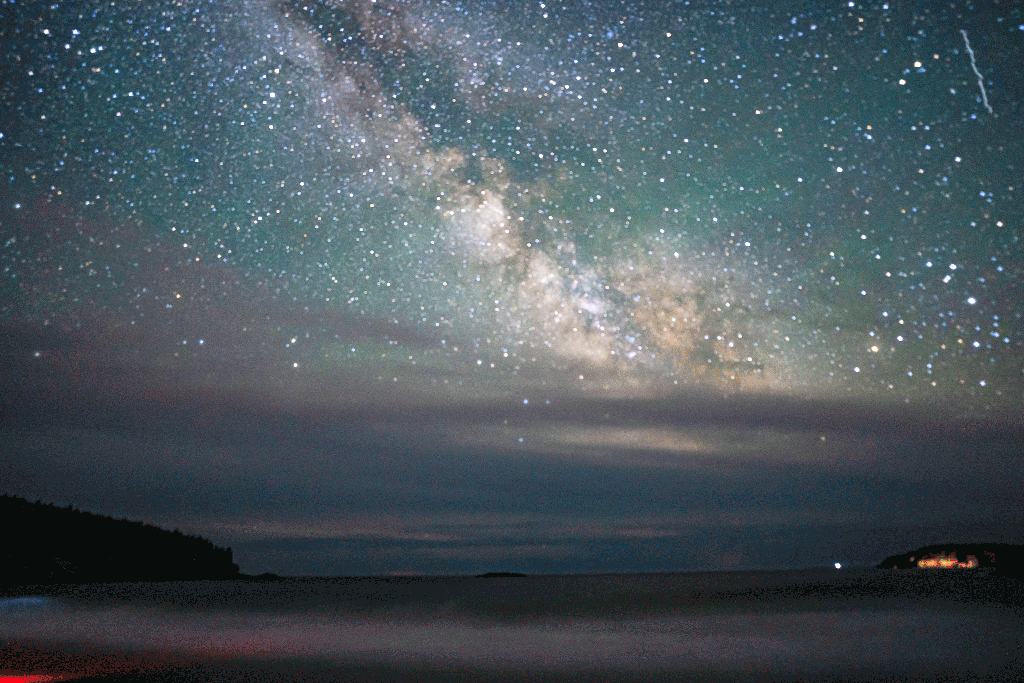
The Ocean Path is a trail running from Sand Beach to Otter Point and has some of the best spots for night sky photography. This was my second nightscape adventure in Acadia. Since I had already scouted the locations on the map earlier during the day, I headed out an hour after sunset when it was pretty dark. The Park Loop Road runs adjacent to the Ocean Path and there are numerous parking lots on this road. I parked at the lot near the Otter Cliff overlook and walked to the Ocean Path.
You must regard your safety as the utmost priority if you are walking the Ocean Path at night. The trail is not lit at all and you will have to rely on a flashlight or a bright LED for navigation. Be sure to be wary of cliffs and slippery rocks if you venture outside the trail for shooting the night sky. Small mistakes can result in serious consequences, but as long as you exercise enough caution, the rewards are worth it. If you are not comfortable doing this, the alternate option is to drive along Park Loop Road and stop for pictures as you need.
The weather on this night was clear with relatively low humidity. The moon had set within the hour after sunset and these were great astrophotography conditions. Below are some shots that came out nicely.
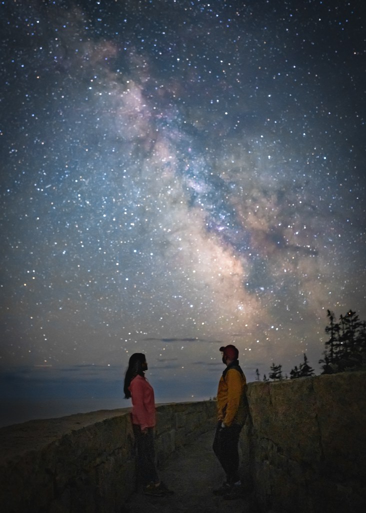
Right: Stargazing with the wife near Otter Cliff Overlook.

Final thoughts
My nightscape adventure in Acadia had both successes and failures, but I felt content with the experience in the end. The final images were close to what I had visualized. The sharpness was not as per my expectation though, which makes me think I should be investing in a better quality tripod next time.
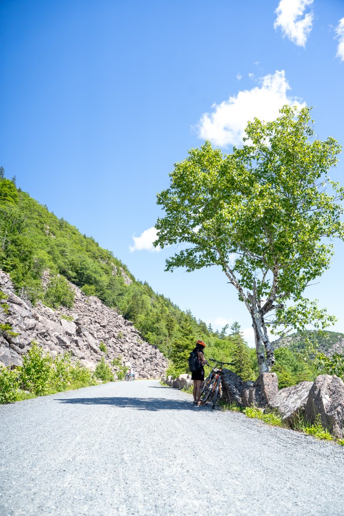
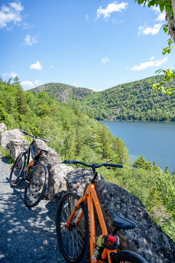
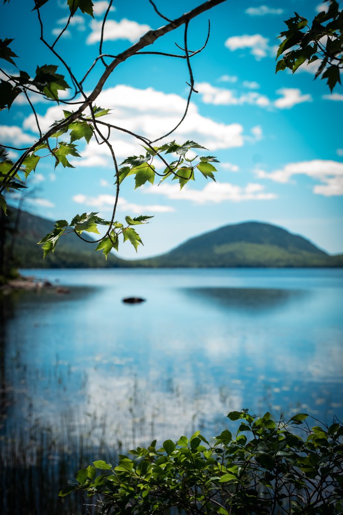
There are numerous other locations too, such as the Jordan Pond or the Eagle Lake which are probably worth exploring as well, but these had to be reserved for my next visit to Acadia.
If you are interested in night sky photography, Acadia National Park should be a top-ranked item on your bucket list.